Cocoa Beach to Port Everglades |
||||||||||||
| Thursday,
May 15, 2003: After a final frenzy of preparing and packing the boat, I finally left Cocoa Beach around 11:30am, the morning of May 15 with the dinghy in tow. The weather was hot and partly cloudy. There was a light south wind. I motored south in the Banana River toward where it meets up with the Indian River at Dragon point. The narrow, winding, poorly marked Banana River channel from Pineda Causeway to Mathers Bridge was as frustrating to navigate as ever. Once I was past the Dragon and in the Intercoastal Waterway, navigation became more like driving down an interstate highway. |
||||||||||||
|
||||||||||||
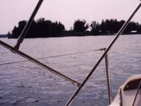
| Around 7:30 that evening, I
anchored for
the night
between Palm Bay and Valkaria just west of "Second Island", south of
ICWCM#18
(Inter Coastal Waterway Channel Marker 18)
(N27*59.358',W080*32.723').
I set the Claw anchor in about 6' of water. I then bailed a
couple
of gallons of spray from the dinghy in preparation for rowing over to
explore
the island. However, it was getting dark, a violent
thunderstorm
was rapidly approaching, and while bailing, I noticed a significant
current
running (from nearby Sebastian Inlet). The VHF radio was
issuing
a scary short term forecast. I fixed dinner and settled in
for
the
night.
I'll also mention that this section of the Intercoastal Waterway, between Cocoa and Fort Pierce, is in my opinion, really beautiful. The river is wide, there are lots of tiny uninhbited islands, many with deep water right up to their beaches, not a lot of boat traffic, very few draw bridges, and the shoreline is not heavily developed compared to further south. |
||||||||||||
| Friday,
May 16, 2003: I enjoyed a leisurely breakfast of scrambled eggs with diced onions, reheated coffee from home, and orange juice. I finally got under way around 9:00am under sail in a light south west wind, which then died immediately. After starting the motor, I noticed the dinghy painter was chafing on the forward seat of the dinghy, so I switched it from the halyard cleat to the bow eye. I motored south at about 4.2 knots until the wind returned around Grant Island. I then raised the mainsail, 135% genoa, and shut down the motor. Speed under sail was maybe 2 to 4 knots. |
||||||||||||
|
||||||||||||
| Around noon, the wind went south and light until 1:00pm, when the sea breeze filled in from the southeast around Sebastian Inlet. Speed picked up to 3 to 4 knots. Just south of the inlet, the wind again went south, straight on the nose in a narrow channel, forcing me to switch to motoring again. Sailing upwind in the ICW is nearly futile. At 4:00pm I stopped at a fuel dock between Wabasso and Vero for 3.6gal of gas, and topped up both water tanks. Around 7:30pm, I anchored for the night just of an island near ICW CM# 169 (N27*33.293',W080*,20.608') in only 3.5' of water using the Claw anchor on a somewhat short scope. During the night, mosquitoes and no-see-ums were annoying, even with the hatch screen in place. It seems that the bugs can eventually find even the smallest gap around the screens. Burning a citronella oil lamp in the cabin seemed to help. |
||||||||||||
| Saturday,
May 17, 2003: Early the next morning, there were several people in kayaks exploring the nearby islands and shallows in the Indian River. While still anchored, I hoisted the dinghy onto the foredeck and lashed it down. This took an hour or two although the water was flat calm. Even distant boat wakes were a problem. I made a mental note not to ever try lifting the dinghy on deck in any kind of waves. I rigged the 110% working jib for later use. |
||||||||||||
| Sunday,
May 18, 2003: I motored down the ICW to Fort Pierce Inlet. Having the dinghy on deck creates quite a blind spot. It looks like lowering the stern in dinghy closer to the deck, even an inch or two, would help. At Ft. Pierce, I stopped at Harbortown Marina, as I have in the past. Even though I'm probably one of their least profitable customers, they always treat me like royalty. I took on 21 lbs of ice, which they delivered to the boat for me, and made change on the spot. I never had to leave the boat, and was in and out in just a few minutes. Having had my fill of motoring down the ICW (a.k.a. "The Ditch"), I was determined to head out Ft. Pierce Inlet, even though I got there after noon. As I approached the inlet, there was a strong ebb tide current running, like several knots. Far to the west, tall storm clouds were building up. As I turned east in the inlet, I was met by an amazing number of small sport fishing boats headed in from the ocean. I mean, maybe 100 inbound boats. I was the only outbound boat. At the breakwater, the outgoing tide confronted the incoming waves pushed by the southeast winds, creating what I call a "washing machine". There were steep standing waves and confused chop up to 6'. At times, the bow of the Catalina 25 was rising and falling 10', with the forward half of the boat out of the water. Once I was clear of the tidal mixing, the waves settled down to more like the 2' seas forecast by NOAA weather radio. I raised sails and began getting a feel for sailing conditions while gaining sea room off the lee shore. The storm clouds to the west reached truly impressive darkness and altitude. The sport fishing fleet continued to stream past me as if pursued by sea monsters. I began to have doubts. Could a couple of hundred local boaters be wrong? Even though I was doing OK, I headed back in. As I bounced back through the washing machine a second time, the ominous clouds dissipated. So I headed back out to sea yet again, even though it was getting late in the day (a third pass through the washing machine). I then sailed south in the ocean at about 5 knots (with dry decks!) until after midnight, when the wind died. The waves, however, lived on. |
||||||||||||
Note: I seem to have gotten the dates on my log book notes mixed up somewhere around here. Some of these paragraphs are undoubtedly out of sequence by at least a day. |
||||||||||||
| Monday,
May 19, 2003: During the night I pass St. Lucie Inlet, but didn't attempt to enter because of darkness, and scary warnings in the cruising guide book. I made it to Jupiter Inlet around dawn. I decided to come in from the ocean because I was getting tired after being awake and under way for about 24 hours. |
||||||||||||
Warning! |
||||||||||||
| I spent the day motoring down "The Ditch"
again. I
passed too
many rude powerboaters, and too many draw bridges. Gripe,
gripe,
gripe! I motored south to Lake Worth where I got ice and free
charts
at Noth Palm Beach Marina. They were nice folks.
I ended up anchoring early that day in the north end of Lake Worth to rest up from my previous lack of sleep. This is a very good anchorage. |
||||||||||||
|
||||||||||||
| Tuesday,
May 20, 2003: I stuck my bow out Lake Worth Inlet to see if it was feasable to continue south in the ocean at that point. Once out in the ocean, I had nice sailing conditions, but the Gulf Stream is only about a half mile off the beach there. To sail south in a southeast wind, I would have to tack in a 1/4 mile wide shallow corridor just west of the Gulf Stream current, and just east of the breakers on the beach to reach the next inlet, Boca Raton, 25 miles further south, in the dark. I sailed around for about 10 miles, and came back in Lake Worth Inlet. I tried to sail in the ICW, but was immediately foiled by draw bridge schedules. Grrr. |
||||||||||||
Here's a few deadly boring,
cryptic,
technical notes
about exploring the edge of the Gulf Stream at Lake Worth Inlet.
In ocean at constant throttle. Heading south (180*) SOG (Speed Over Ground) = 1.0 knot. Heading north (0*) SOG = 9.0 knot. Current = (9-1)/2 = 4.0 knots.(End of boring cryptic notes) |
||||||||||||
| (Back to motoring down the ditch) The day was spend motoring between endless rows of tightly packed pretencious new mansions. What wretched excess. Around 10:00pm, I spotted an Eckerd's Drugs near a public boat ramp. By the time I got turned around, tied up, closed up the boat, and walked to the store, it had closed for the night. While docking, I noticed that the Yamaha outboard would tilt up under power in reverse. The next morning, I found that the tilt trim pin was missing. A 5/16"x6" bolt & nut would have worked well as a jury rig, but for lack of one, I ended up using 2-1/2" and 3" bolts jammed end-to-end in the same nut for the time being. I motored late into the night looking for a good place to anchor. I finally found a very small cove off the ICW channel at ICW CM # 57 around midnight. (N26*,22.416',W080*,04.330') |
||||||||||||
|
||||||||||||
| About to run off of local navigation charts on board,
need
to get more
charts. The large number of draw bridges opening on a fixed
schedule
is very bothersome, and prevents sailing in this portion of the
ICW.
Docked at "The Cove", south of Boca Raton Inlet
(N26*,18.84',W080*,04.85'). Back at the Cove, I had a great salmon dinner in their restaurant. I asked about anchorages a few miles to the south. |
||||||||||||
|
||||||||||||
| The Los Olas anchorage was miserable. It
was small,
tight, up
against the busy ICW channel at a drawbridge, packed with moorings and
very crowded, had an amazing current running (near Port Everglades
Inlet)
counter to the wind at the time, and a deep, scoured rock bottom for
holding
ground. I tried to get a hook to hold twice, and then moved
on
the
Lake Sylvia (hug the east shoreline entering and leaving).
Lake Sylvia was an ideal anchorage by
comparison. It
was large,
deep enough at low tide, good holding ground, and no significant
current.
When I first arrived, there were only two other boats
anchored.
(N26*,6.290',W080*,6.715')
The ocean weather forcast was not favorable for small craft this day. Winds northeast 10 to 15 knots, seas 4' to 6'. Yuck! Checked stbd water tank -- nearly empty! Need to remember to top up water whenever available, and make an effort to use less. Maybe leave pressure pump off, and use hand pump only, except for large draws like bathing. Also consider filling portable 5gal. water jug and solar showers at water stops, then dump into tanks a few days later as space becomes available. Also start saving melted ice for washing. House battery bank = 12.36V at 11:am, May 21. |
||||||||||||
| Thursday,
May 22, 2003: A damp day in paradise, and a slow day in "Liquerdale". The day dawned overcast with a strong northest wind. It rained half the time, mostly light, but a few downpours. I went back to sleep. Around noon the wind went south. I made a large breakfast of apple and apricot pancakes and brewed a batch of strong coffee. Miami area public radio, WDNA, plays Latin jazz most of the day, with the usual drive time syndicated news shows. I straightened up around the boat. I brainstormed using the Claw bow anchor (my favorite) with the dinghy on deck blocking the anchor locker. Settled on temporarily storing 30' chain and some nylon rode in a bucket lashed down on top of the anchor locker hatch. For amusement, I motored up New River as far as the first draw bridge. That's a pretty area, I wish my hands had been free long enough to snap some photos. Nice old waterfront homes, clearly affluent, but not ostentacious about it. It's worth mentioning that the New River had an impresively strong current running. It's also narrow, twisting, bounded by concrete seawalls and docked boats, and has some submerged rocks. And then there are the ferry boats in a hurry and the large yachts that barely fit all by themselves. On the way back from New River, I stopped off at Lauderdale Marina for ice and water, and to make a quick update phone call to my float plan contact. Back at Lake Sylvia, there were now about six boats anchored, waiting out the weather. A big motor yacht, "ESSCO", cranked out old Mo Town hits until past sunset. By 5:00pm the wind had backed to the southeast. NOAA weather radio says Gulf Stream conditions poor, but expected to improve next two days. |
||||||||||||
| Next: Crossing the Gulf Stream East Bound, May 23 and 24. |
| Or, return to: [ Top Level Travel Log Navigation Table ] |
